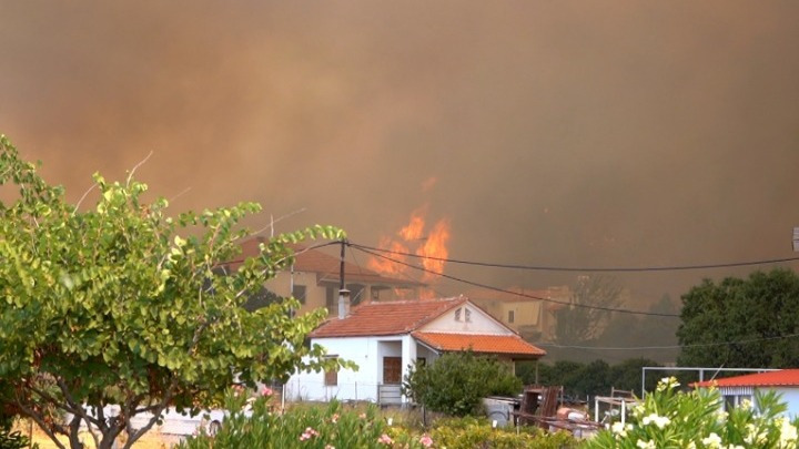
The mayor of western Lesvos Taxiarchis Verros on Sunday afternoon ordered the precautionary evacuation of the village of Vrisa as a wildfire continued to rage on the island for a second consecutive day. A message sent to people in Vrisa via the 112 emergency number instructed them to evacuate due to a forest fire in the vicinity and head toward Polichnito, where a centre to receive them has been set up.
Fifteen hours after the major fire began, the main front of the fire had reached the edges of the village, which had been devastated by a major earthquake in 2017. The fire is moving from Vrisa to Vasilika, where fire fighters, volunteers, residents and visitors to the area are battling to prevent the flames reaching the village.
Shortly afterward, residents of the village of Stavros on the island of Lesvos were also ordered to evacuate as a precaution, in a second SMS sent via the 112 emergency number.
The message ordered anyone in the vicinity of Stavros to evacuate toward Vatera due to a fire in their area.
The evacuation was ordered by the mayor when winds caused the fire to rekindle after it was put out and head in the direction of Stavros. Fire fighters are mainly focusing their efforts to the north of the village, to prevent the flames from reaching a large forest on the south flank of the island’s Mount Olympos.
EU’s Copernicus mapping service activated for Vatera fire
The EU’s Copernicus Emergency Management Service-Mapping has been activated to map the burnt areas in Vatera, the climate crisis and civil protection ministry announced on Sunday.
The maps, which will be created through the analysis of satellite images, will assist the agencies involved in dealing with emergency needs and managing the impact of the fires. The request has been accepted by EU services and the maps will be given to the civil protection service and all other bodies involved free of charge.
SOURCE; ANA-MPA


